The Kettles Map Project is a cooperative team of cartographers, athletes, wildlife photographers, and guide book authors collaborating to create the first and only comprehensive map of the Kettle River Range in Ferry County, Washington State. Located only two hours from Spokane, the Kettle Range is the home of solitude, sacredness, and room to roam for all types of human-powered users.
The goal of the Kettles Map Project is to conduct field mapping and next-generation cartography in the Kettle Range in order to provide an accurate assessment of this changing landscape. Through our work on the physical map, the online hub, and the app, we will invite new visitors into the numinous Colville National Forest’s forgotten corner, The Kettle Range.
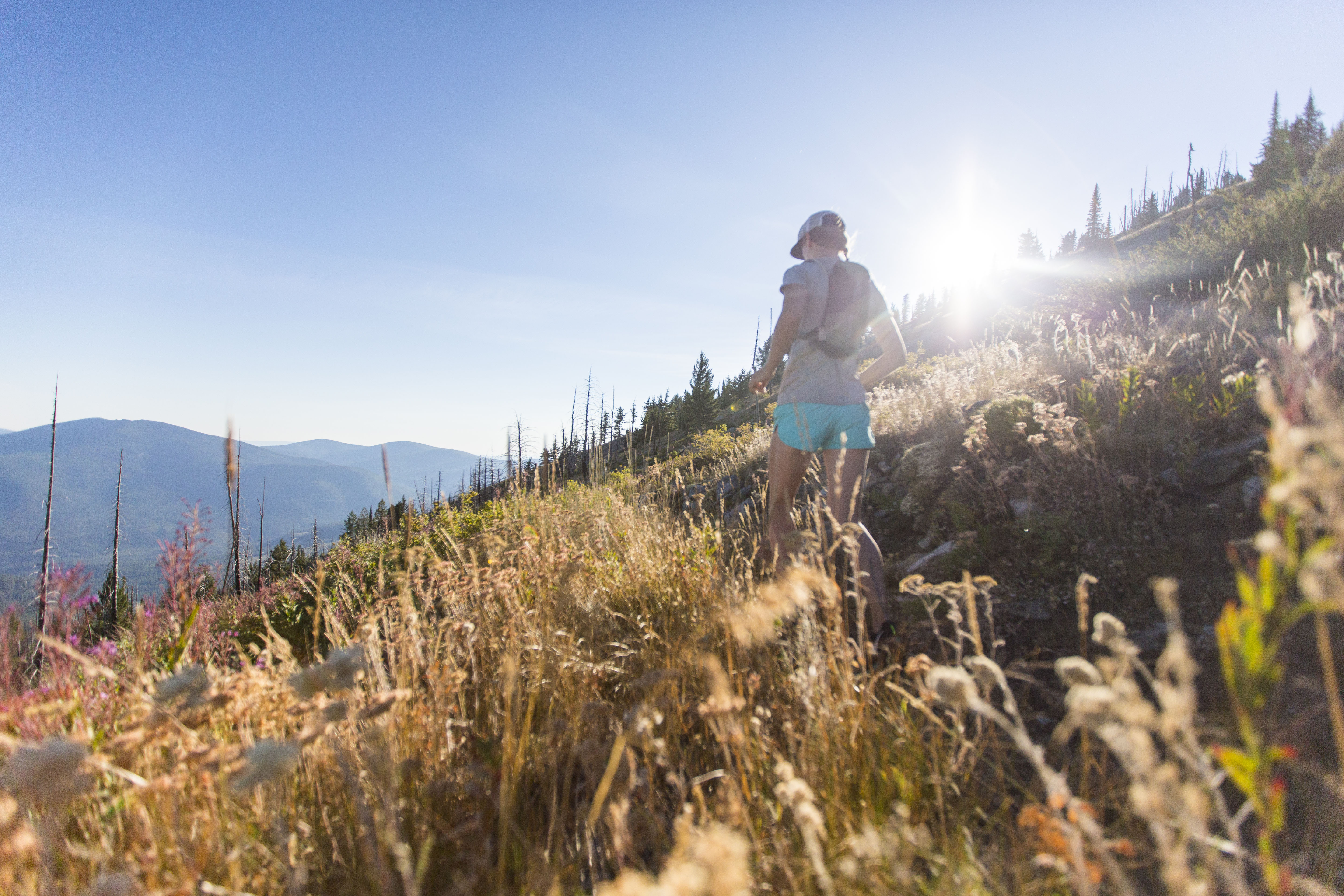
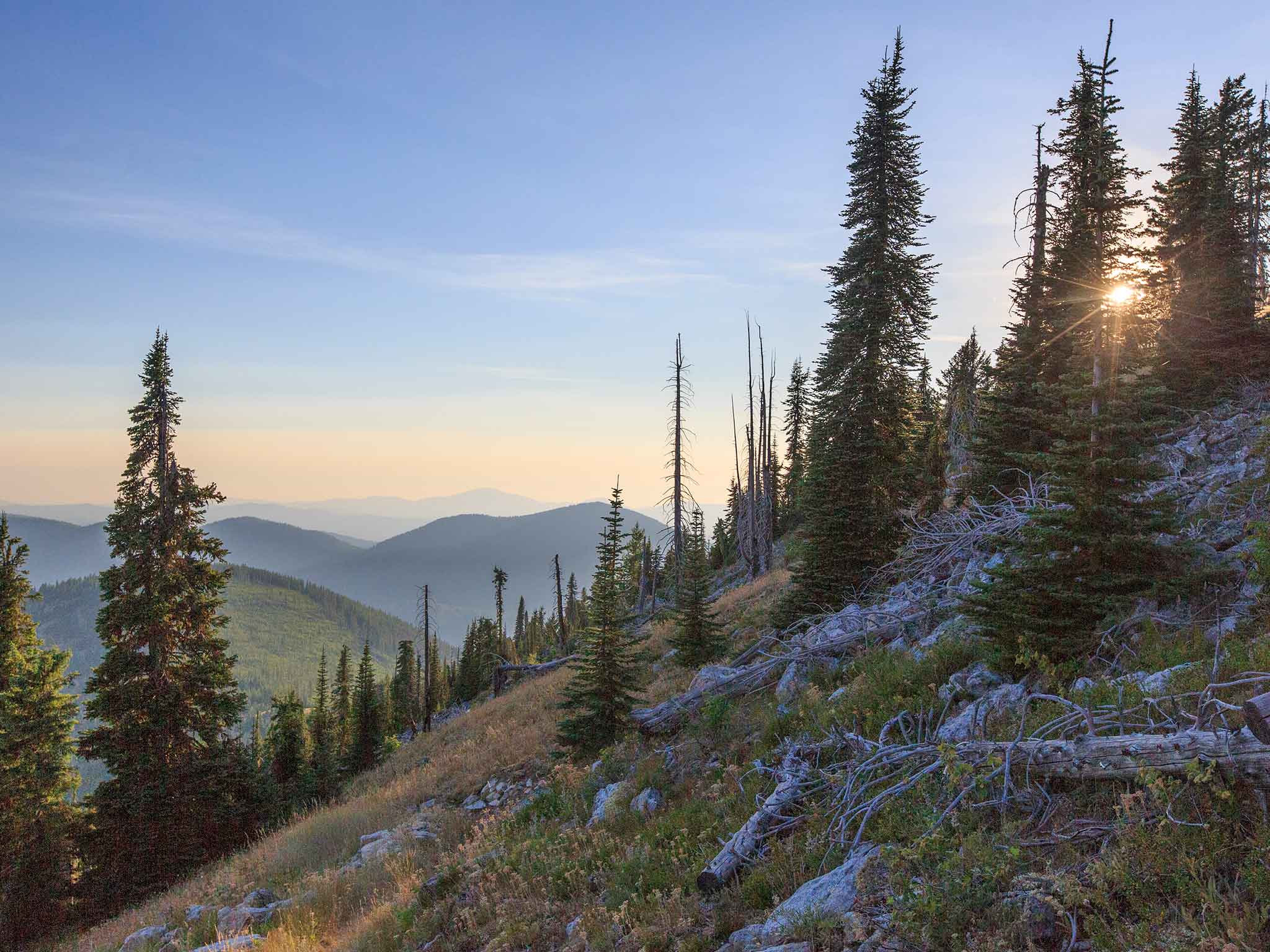
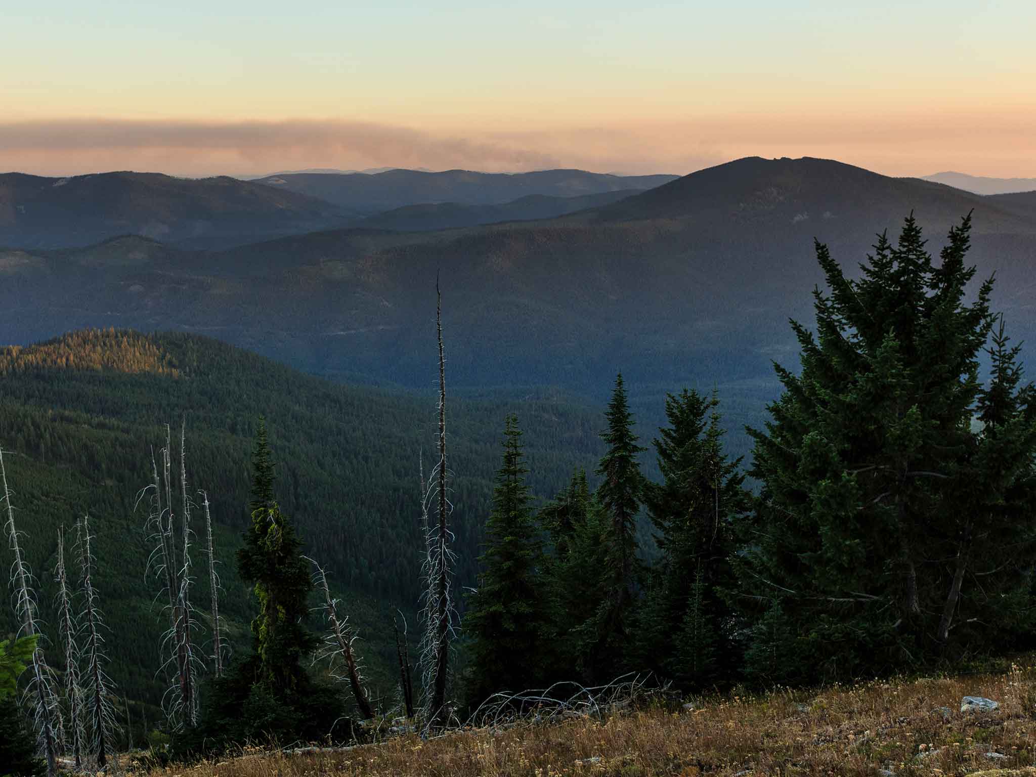
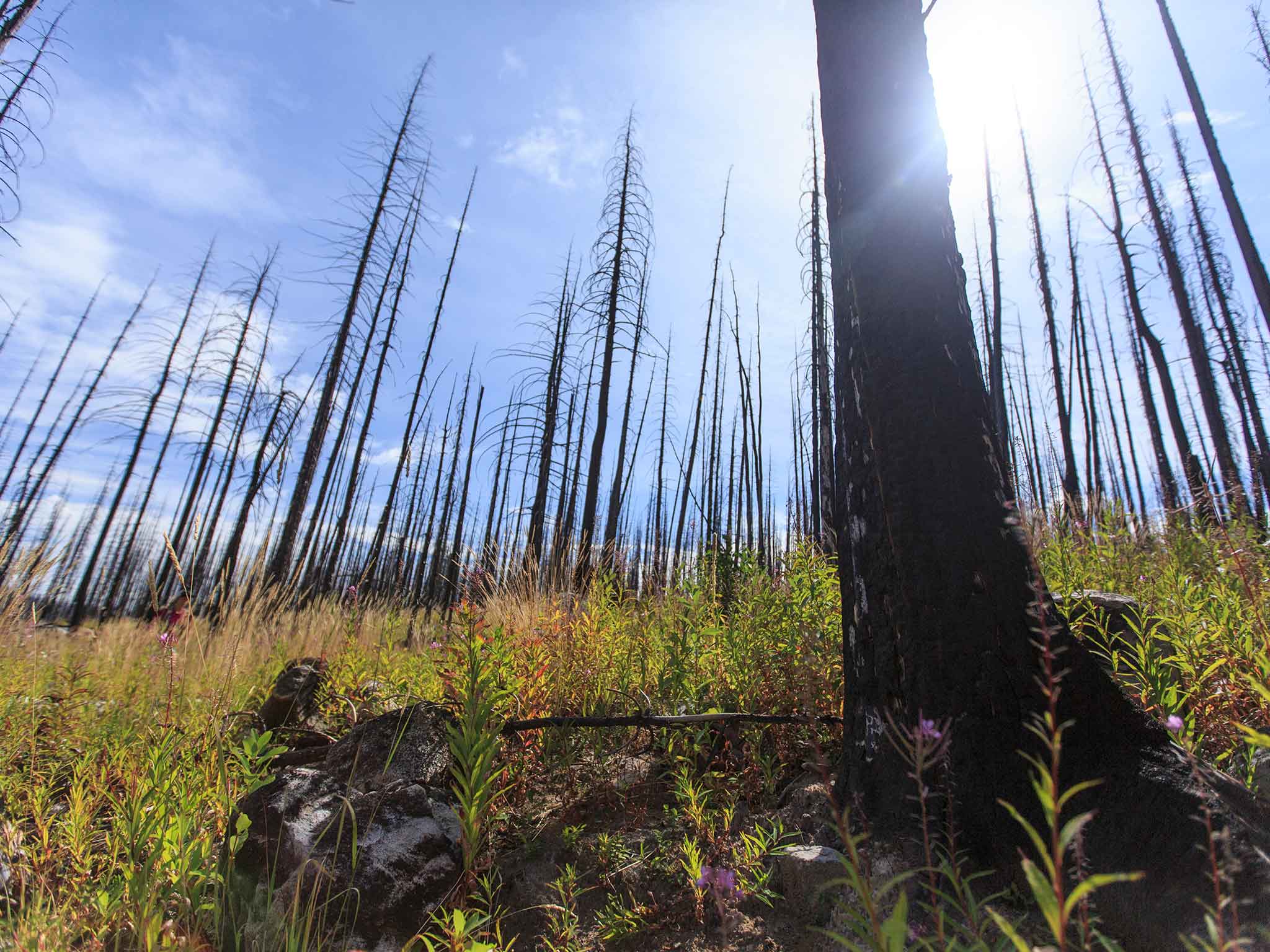
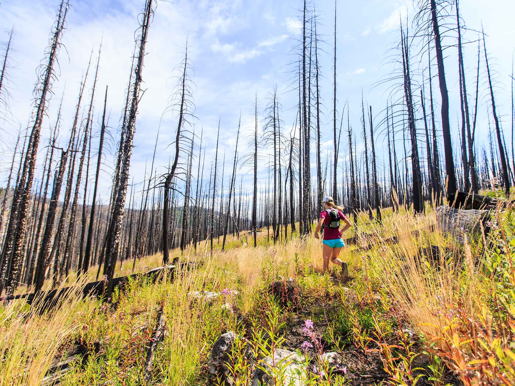
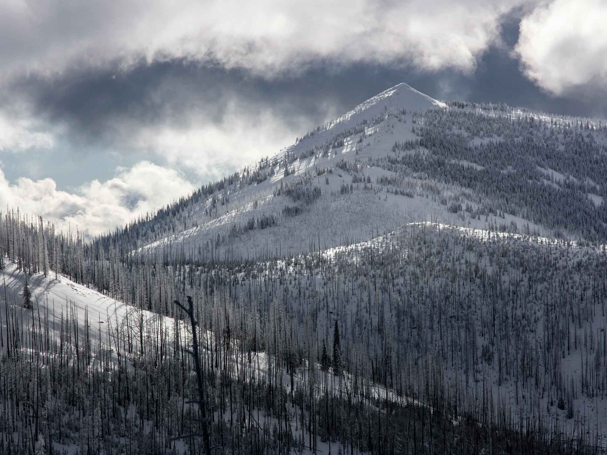
A part of the broader Columbia Highlands Zone, the Kettle Range is the southernmost of the Monashees and the westernmost of the Rockies. This prominent fin, hewn of granite, rises between the Columbia River on its eastern flanks and the town of Republic and San Poil River on its west while the namesake Kettle River wraps the northern terminus of the Range before spilling into the Columbia on the east. Bear, moose, and wolf all make their homes here. The Range is home to a variety of uses encompassing proposed wilderness, cattle ranching, timber harvest, hunting, and non-motorized recreation. These interests converge on a range touched many times by the wildfires that have been heating up the Inland Northwest in recent decades.
This project encompasses three distinct trail systems: the Kettle Crest Trail, a forty-plus mile high route maintaining the picturesque ridge-crest of this remote granite fin; The Ferry County Rail Trail, a family-friendly reclaimed railroad corridor preserved for non-motorized recreation in the Curlew Valley; and a portion of the Pacific Northwest Trail, a 1,200 mile trail beginning in Glacier National Park and terminating on the Olympic Peninsula. The Kettle Crest National Recreation Trail maintains virtually the crest of the ridge from south to north while the recently-completed Ferry County Rail Trail provides an ADA-accessible and family-friendly option for outdoors people in the Curlew Valley. The Pacific Northwest Trail shares the Kettle Crest Trail then marches on through Republic on its meander westward.
Located conveniently near the Kettles are the towns of Republic, Curlew, and Kettle Falls—two of which have sweet natural foods stores and all of them boast beautiful riverfront. No kitschy Western- or Bavarian-themed towns here! Our final website for the Kettles Map Project will include a robust array of local eateries, bars, and nice places to stay in these great little mountain towns.

Because we love the Kettles - and we think you will, too. In order to visit and enjoy yourself, though, you need a map. That's where we come in.
As Spokane, the fourth most populous urban center in Washington State, grows its residents increasingly seek uncrowded places in which to recreate. There are few areas within a two-hour drive of this growing urban center offering the breadth of activity that the Kettles offer. A map will allow would-be bikers, hikers, birders, runners, hunters, backpackers, and skiers to access the range without the headache of searching multiple different maps and websites to compile a plan, find the right trailhead, and choose a place to stay.
Project timing is coordinated with a Washington Trails Association work party set for Spring 2019 to clear the northern two-thirds of the Kettle Crest Trail, a stretch of trail heavily impacted by the 2015 Stickpin wildfire. When the trail is buffed out, you'll have this map to aid in your weekend trip.
This map has never been made before. We look forward to putting it in your hot little hands Summer 2019.
All sorts of human-powered users can enjoy time in the Kettles. The Ferry County Rail Trail offers groomed surfaces in the winters for cross-county skiers and fatbikers while the Kettle Range boasts dry continental snow perfect for backcountry skiers and Highway 20, which bisects the Range at its midpoint, remains plowed all winter long.
In the summer, the intrepid mountain mover will appreciate the Kettle Crest Trail completed as either a multi-day backpacking trip or a single-day long run. A casual nature-lover will enjoy this trail taken bit by bit as day hikes throughout the season. There are portions of the Range that are open to mountain bikes and road cyclists will enjoy the steep climb and curvy descent up and over Sherman Pass. Locals can even use the Rail Trail as a commute route or a place to take a simple walk with their families after work.
Camping, hunting, fishing, and birding opportunities abound whether accessed on the Rail Trail or on the Crest.


The primary goal of the Kettles Map Project is to create the first focused, comprehensive map of the Kettle Range and build the online community to support new users visiting the area. We'll do this by conducting modern cartographic mapping of the Range and the Ferry County Rail Trail, distributing a physical and digital map of both in order to inspire broader public engagement with this forgotten range. We will show future visitors this haunting region through images, presentations, and written articles. Our hope is that this map is a conduit not only for regional economic development but a catalyst for attracting conservation-oriented recreators to the area.


The Kettles Map Team began cartographic expeditions to the remote reaches of the Range beginning in Spring 2017. Our field research will continue into Summer 2019.
Our research goals include:
The Kettles Map Project is a collaborative of cartographers, athletes, coders, wildlife photographers, and guide book authors.

Brittany Aäe is an endurance coach and creative in unceded Methow territory. Brittany is a process-oriented mountain athlete, curious about the practice of alpinism rather than the outcome of a specific goal. Her background encompasses solo, unsupported mountain ultras; alpine climbing; and backcountry skiing. As an outdoor professional she has served on Search and Rescue teams and co-led expeditions in the Great Ranges. Prior to founding her business, Magnetic North, in 2012 she spent a decade researching, planning, implementing, and evaluating large-scale public health programs on four continents.
Brittany holds a BA in Political Science, a Wilderness First Responder, and an AIARE Avalanche II. She writes, meditates, and moves in the mountains every day.
Marc Rothmeyer has twenty-five years’ experience designing, developing, and marketing maps, apps, and GIS databases. Working for private corporations, federal, and local governments he has been project manager on over forty field surveys across North America, Asia, and the Pacific. He has published more than fifty top selling recreation trail maps from New York City's Central Park and Haleakala National Park to Saguaro National Park and Washington State's Olympic Coastal Wilderness.
He is the founder of Dharma Maps which specializes in mountain cartography and publishes recreation topographic maps. Marc is also the co-founder of Mobcoder, an international technology collaborative which consults in GIS, web map design, and geo-app development. He holds degrees in GIS, Cartography, and Natural Resource Management from Western Washington University and splits his time between Winthrop and Seattle, Washington.
Collaborators:
Craig Romano is one of the most prolific trails writers in the Northwest having authored more than twenty books covering the region. His Columbia Highlands: Exploring Washington’s Last Frontier, was recognized in 2010 by Washington Secretary of State, Sam Reed and State Librarian, Jan Walsh as a Washington Reads book for its contribution to Washington’s cultural heritage. Romano has hiked more than 25,000 miles in Washington alone from the Olympic Peninsula to the Blue Mountains.
David Moskowitz works in the fields of photography, wildlife biology and education. He is the photographer and author of three books: Caribou Rainforest, Wildlife of the Pacific Northwest and Wolves in the Land of Salmon. He has contributed his technical expertise to a wide variety of wildlife studies regionally and in the Canadian and U.S. Rocky mountains, focusing on using tracking and other non-invasive methods to study wildlife ecology and promote conservation. He helped establish the Cascade Citizen Wildlife Monitoring Project, a citizen science effort to search for and monitor rare and sensitive wildlife in the Cascades and other Northwest wildlands. David holds a bachelor’s degree in Environmental Studies and Outdoor Education from Prescott College. David is certified as a Track and Sign Specialist, Trailing Specialist, and Senior Tracker through Cybertracker Conservation and is an Evaluator for this rigorous international professional certification program.


Your funds will go directly to covering the cost of our field work in the Kettle Range and the production of educational materials. Creating this map is vital as we move toward diverse use designations of previously-homogenous Forest Service land and in order to attract new users to the Range. Your contribution through Kickstarter will support:
Field Expenses
Marketing Expenses
Cartography Expenses


Registration successful. Activation email has been sent. Please check your mail..
Enter the verification code we just sent
you on your Email Address.
Enter the verification code we just sent
you on your Phone.
If you didn’t receive a code! Resend